The Layers of Time
The People of Antiquity Had an Antiquity of Their Own
EN / TR
I am neither inside time,
nor wholly outside it;
but in the unbreakable flow
of one vast, seamless moment.
The most popular films made from the Odyssey and the Iliad came roughly 2,750 years after the epics were first committed to writing: Wolfgang Petersen’s Troy in 2004 and Christopher Nolan’s Odyssey in 2026. The Iliad covers the last 50 days of the Trojan War and ends with Hector's funeral. The film overlaps a little with the Odyssey. As a film, I love Troy. I think it was a very successful epic Hollywood blockbuster. Looking back now, it failed to recoup its production cost domestically at the box office, but made three times that worldwide.Source: Budget and box office figures for Troy (2004): Box Office Mojo. Roughly $175m budget, $133m in the US and Canada, $497m worldwide. When I hear “the Trojan War,” scenes from that film are what come to my mind too. Yet until the last couple of years, the only thing in my head about the historical reality of it was: “a war fought in Çanakkale in antiquity, Homer wrote about it, it became an epic.” But every stone you turn over on this subject reveals another research topic underneath: from the story of how the epic reached us, to how the mounds called höyük form, to the perspective on the past held by the people we call ancient, to where geological change on the earth’s surface sits on the scale of human history.
The Trojan War holds an important place in Anatolia’s history too. A few events in the past have had the phrase “Troy has been avenged” attributed to them:
1. Mehmed the Conqueror (1462): the only sourced example
This is the strongest and genuinely documented example. During the 1462 Lesbos campaign, Mehmed the Conqueror visits the ruins of Troy (Ilion), asks after the tombs of Achilles and Ajax, praises the heroes, and speaks to this effect:
“It was to me that fell the lot, after so long a time, of avenging this city and its people. For it was the Greeks, Macedonians, Thessalians and Peloponnesians who laid it waste; and their descendants have now, through me, paid the penalty for the injustice they did to us Asians, then and in the times that followed.”Source: Michael Kritovoulos of Imbros, History of Mehmed the Conqueror, book IV. Greek text: Critobuli Imbriotae Historiae, ed. Diether Roderich Reinsch, Corpus Fontium Historiae Byzantinae 22 (Berlin: De Gruyter, 1983); English translation by Charles T. Riggs (Princeton: Princeton University Press, 1954). Kritovoulos was an Ottoman bureaucrat of Greek origin who dedicated his work directly to Mehmed. That is, a contemporary source close to the court. The claim that Mehmed framed the 1453 conquest of Constantinople the same way is generally derived from this passage.
2. The saying attributed to Atatürk: very widespread, but unsourced
After the 1922 Great Offensive and the entry into İzmir, Atatürk is said to have declared “We have avenged the Trojans.” But no primary source for this can be produced. No such statement appears in Nutuk or in the collected Speeches and Statements of Atatürk; the story is generally repeated second- or third-hand, without a citation.Where it isn’t: Mustafa Kemal Atatürk, Nutuk (Ankara, 1927), and Atatürk’ün Söylev ve Demeçleri (Speeches and Statements of Atatürk), 3 vols. (Ankara: Atatürk Research Centre). The phrase appears in neither of these two core corpora, and no publication has yet traced it to a primary record.
The Epic and the City
The Trojan War is fascinating in two respects. The first is the road these epics, written about the war and its aftermath, travelled to reach us. The second, and the central example of the question of time scale I’ll try to touch on in this piece, is the city of Troy’s own history.
How the Epic Reached Us
The first interesting point. The war takes place toward the end of the Bronze Age, somewhere around 1150–1200 BC. When HomerIncidentally, it isn’t even clear whether Homer was one person or a group of bards. as master bard dictated it into writing, the year was around 700 BC. So for the roughly 450 years in between, this story was passed down entirely orally, from bard to bard, generation to generation. The reason it was written down in Homer’s time is that the Phoenician alphabet was adapted to Greek in that period. The Phoenician alphabet had been spreading across the Mediterranean since around 1000 BC; once the Greeks added vowels to it around 800 BC and built their own alphabet, they used it to record the epic while they had the chance. By the time it was written down, 450 years had passed since the Trojan War. It’s rather like an event from the 1600s being written down for the first time now.Source: On the technique of oral composition, Milman Parry, The Making of Homeric Verse, ed. Adam Parry (Oxford: Clarendon Press, 1971), and Albert B. Lord, The Singer of Tales (Cambridge, MA: Harvard University Press, 1960). On the arrival of the alphabet and the writing down of the epic, Barry B. Powell, Homer and the Origin of the Greek Alphabet (Cambridge: Cambridge University Press, 1991); on the dating, M. L. West, “The Date of the Iliad,” Museum Helveticum 52 (1995): 203–219. For Homer, Achilles was 15 generations back. And consider: Ancient Greece, the age of Socrates, Plato and Aristotle, would come 400 years after Homer had this written down. These famous philosophers, ancient from where we stand, would look at the Iliad from the same vantage point we do: an epic out of the very distant past. Four hundred years later, Aristotle would praise Homer in the Poetics for choosing a single portion of the war rather than narrating all of it.Source: Aristotle, Poetics 23, 1459a30–37.
The epic’s own journey through the world went like this:
- Before writing, it was carried for centuries by oral tradition.
- Homer had it written down around 700 BC.
- Athens, in the 500s BC, made official written copies mandatory so that bards would not corrupt the story.
- Scholars at the Library of Alexandria edited the texts and divided each into the 24 “books” we still use today.
- The Byzantines hand-copied the crumbling papyrus onto durable parchment throughout the Middle Ages.
- After the conquest of Constantinople in 1453, Greek scholars fled to Italy with their manuscripts, and it was printed for the first time in Florence in 1488.Source: On the history of the text, M. L. West, Studies in the Text and Transmission of the Iliad (Munich: K. G. Saur, 2001), and Gregory Nagy, Poetry as Performance: Homer and Beyond (Cambridge: Cambridge University Press, 1996). The official Athenian copy (the “Peisistratean recension”) rests on ancient reports and is disputed today: Cicero, De oratore III.137; Pausanias VII.26.13. Editio princeps: Homeri Opera, ed. Demetrios Chalkondyles (Florence, 1488).
The City
The Bronze Age Hittites kept records. Their tablets speak of a region in western Anatolia called Taruisa/Taruwisa and of a city there named Wilusa. This resembles the Greek Troia and Ilios (Ilion). The Iliad takes its name from the latter. The tablets also mention a people called Ahhiyawa; these are almost certainly the Achaeans, that is, the Greeks.One Hittite treaty gives the name of the king of Troy as Alaksandu. That is startlingly close to Alexandros, Prince Paris’s other name in the Iliad. The Trojans were not exactly Hittites; they were the Luwians, a western Anatolian people, close cultural cousins from the same Indo-European family.
The city sits in a critical position, at the mouth of the strait where ships waited for the northeasterly to pass, and so it grew rich as time went on; that is also why the Mycenaeans, the ancestors of the ancient Greeks, attacked it. Although the legendary cause of the Trojan War in the epic is Helen, the real cause was gaining control of this harbour.
Are Mycenaeans, Achaeans and Greeks the Same Thing?

These names all point at the same people, but the people who gave the names are different. All of them are a population living in that region who can be counted as the ancestors of the Greeks, but who had not yet been gathered under a single identity the way “Greek” implies.
Mycenaeans is the name Schliemann gave after digging Mycenae in 1876, following Troy. So the man who dug Troy also named the people who attacked it. Give this man an inch and he’ll muddle everything up. They were already called Achaeans; why go and coin a name of your own?
Achaeans is the name the era used for itself. Homer addresses the army that comes to Troy by three names: Achaioi, Danaoi, Argeioi. Not once does he say “Hellene.”Source: Thucydides, History of the Peloponnesian War I.3, states explicitly that Homer never calls them all “Hellenes” but “Danaans, Argives, Achaeans.” In Homer’s day there was no collective name “Hellenes,” because there was no collective identity.In the classical period Achaea is merely a small region in the northern Peloponnese; Rome would later apply the name to the whole of Greece as a province. And the name occurs outside the epic as well: Ahhiyawa in the Hittite tablets. So “Achaean” is not a modern term; it is the name used at the time, standing both in the Bronze Age’s own records and in the epic.
Greeks is the name of an identity born later, and that identity has three separate names, each coming from somewhere else. Hellenes is what they called themselves; it turns into a shared identity only after the 8th century BC, around the Olympics, Delphi and common sanctuaries, and hardens further with the “barbarian” antithesis of the Persian Wars. Greek is the Latins’ name: the first group the Romans came to know were the Graikoi, whom Aristotle places around Dodona; Latin Graeci starts there and spreads to the whole people. And Yunan, the Turkish word, is the East’s name: Yauna, what the Persians called the Ionians of western Anatolia, which passed through Aramaic and Arabic as Yūnān and on into Turkish.
Which leads to this: telling the Trojan War as “the Greeks against the Trojans” is in fact an anachronism. In 1200 BC there is no such thing as Greece; there are separate palace kingdoms that do not consider themselves one people. That idea of a single people is born some 500 years after the war, inside the very epic that narrates it. The epic doesn’t only transmit the war; it also turns the people who fought it into a single “we” for the first time.
Ten Cities Stacked on the Same Hill
And here is the part I find most incredible: for a Trojan standing on those walls during the Trojan War, the first stone of the city underfoot was already 1,800 years back — the distance at which we look at the Roman Empire. They had an antiquity of their own, and it sat inside the very hill they were standing on.
Historically it has generally been assumed that the Trojan War really happened but that its mythological elements were legend. Where exactly the city of Ilion mentioned in the war stood, however, could not be proven. The argument ran on and on through history. Finally, in the 1870s, a German businessman and treasure hunter named Heinrich Schliemann came to the Çanakkale area and started digging into a low hill called Hisarlık. With hundreds of workers he cut a vast trench down through the middle of the mound, and out came walled cities piled one on top of another, burned again and again, rebuilt again and again.Source: Heinrich Schliemann, Ilios: The City and Country of the Trojans (London: John Murray, 1880) and Troja (London: John Murray, 1884). For a critical assessment of his methods and claims, David A. Traill, Schliemann of Troy: Treasure and Deceit (London: John Murray, 1995). For Frank Calvert, who pointed at the hill before him, Susan Heuck Allen, Finding the Walls of Troy: Frank Calvert and Heinrich Schliemann at Hisarlik (Berkeley: University of California Press, 1999).
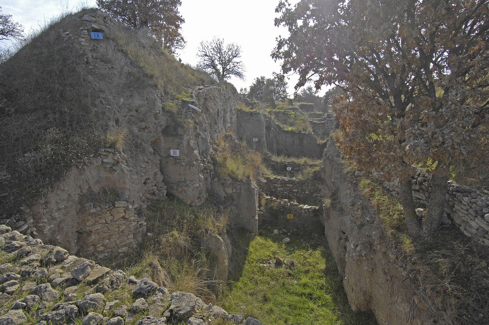
In that hill Schliemann dug into Höyük (tell): a "stack of pancakes" made of cities, each built on the rubble of the one before. On the geoarchaeology of tell formation: Arlene Miller Rosen, Cities of Clay: The Geoarchaeology of Tells (Chicago: University of Chicago Press, 1986). there are nine main cities heaped on one another, plus a layer for the post-Roman Byzantine period that the excavation team unofficially calls Troy X.Source (table below): For the sequence of layers and their dates, Carl W. Blegen et al., Troy: Excavations Conducted by the University of Cincinnati, 1932–1938, 4 vols. (Princeton: Princeton University Press, 1950–1958), and the annual reports of the excavations directed by Manfred Korfmann, Studia Troica 1–15 (Mainz: Philipp von Zabern, 1991–2005). Synthesis: Ernst Pernicka, C. Brian Rose and Peter Jablonka, eds., Troia 1987–2012: Grabungen und Forschungen (Bonn: Habelt, 2014). For Troy VIII–X (the Hellenistic, Roman and Byzantine layers), C. Brian Rose, The Archaeology of Greek and Roman Troy (Cambridge: Cambridge University Press, 2014).

| Layer | Date | What happened |
|---|---|---|
| Troy I | ~3000–2550 BC | Small walled citadel, megaron houses on stone foundations. Destroyed by fire. |
| Troy II | ~2550–2300 BC | Monumental ramp and megaron, goldsmithing. What Schliemann took for “Priam’s Treasure” came out of this layer. Destroyed by fire. |
| Troy III | ~2300–2150 BC | Impoverishment; small houses crammed inside the walls. |
| Troy IV | ~2150–1900 BC | Uneventful centuries along the same modest line. |
| Troy V | ~1900–1750 BC | Recovery, planned building layout. |
| Troy VI | ~1750–1300 BC | The peak period. Massive sloping limestone walls, towers, the first horse bones, imported Mycenaean pottery, a lower town with a ditch outside the walls. Most likely destroyed by earthquake. |
| Troy VIIa | ~1300–1180 BC | Severe overcrowding, storage jars sunk into floors, arrowheads lodged in walls, unburied bodies, a city-wide burn layer. The best physical candidate for the war Homer describes. |
| Troy VIIb | ~1180–950 BC | Resettlement on top of the ruins. Handmade “knobbed ware” points to a new population arriving from the Balkans. |
| (thin interruption) | ~950–750 BC | Settlement thinned out considerably. Once thought to be “complete abandonment”; disputed today. |
| Troy VIII | ~750–85 BC | Aeolian Greeks refound the city. The Temple of Athena Ilias becomes a regional cult centre. Xerxes sacrifices here in 480 BC, Alexander in 334 BC. In 85 BC the Roman general Fimbria sacks it. |
| Troy IX | 85 BC – ~AD 500 | Rome’s Ilium Novum: theatre, odeon, baths, council house. A privileged kindred city, since Rome counted itself Trojan through Aeneas. Heavily damaged by the earthquake of ~AD 500. |
| Troy X | ~AD 500–1300 | Byzantine Ilion. Bishopric, basilica, cemetery. It fades out toward the 13th century; by Ottoman times the hill is farmland and its name is Hisarlık. |
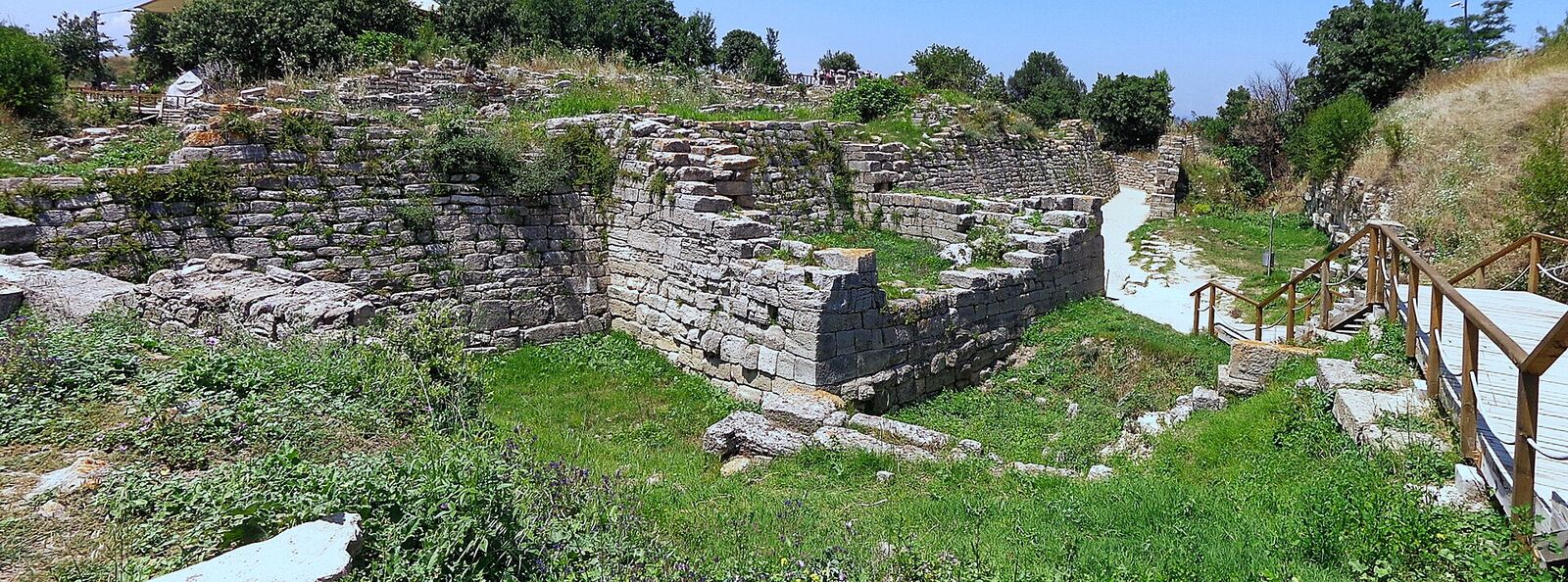
The nine main cities break down into 46 strata in all; from ~3000 BC to ~AD 1300.Source: For the count of strata and the total depth of the mound, Pernicka, Rose and Jablonka, eds., Troia 1987–2012 (2014); for a short overview, Peter Jablonka, “Troy,” in The Oxford Handbook of the Bronze Age Aegean, ed. Eric H. Cline (Oxford: Oxford University Press, 2010).
Listing these layers from a distance like this is easy. But think about the time within each layer in terms of a single life. Each layer holds generations, grandfather to grandchild; a person who spent an entire life inside Troy VIIa experienced it as static, permanent, the only world there was. Childhoods, meals, arguments, harvests, decades of ordinary life. And today, from where we stand, that whole vast lifetime is compressed into a thin band of ash a centimetre thick.
The hill the city stands on holds roughly 4,500 years of unbroken settlement. And when Mehmed the Conqueror arrived there in 1462, not even two centuries had passed since the last settlement.
So Troy was not a “lost city.” It lived on for another 2,500 years after Homer’s war. In the Hellenistic-Roman period its name was Ilium Novum. It was a place with a temple of Athena Ilias, a theatre, walls, a place Rome granted privileges to as “the city of our ancestors.” And it was a regular pilgrimage stop:
- Xerxes (480 BC) called in before crossing to Greece and sacrificed to Athena.
- Alexander (334 BC), the moment he set foot in Asia, went there, poured oil on Achilles’ tomb and ran naked, and took armour from the temple.
- Caesar, Augustus and Caracalla stopped by; Caracalla staged a Patroclus-imitating funeral there for his friend Festus.
- Julian (~AD 354) describes his visit in one of his own letters: bishop Pegasios guided him, and the altar at Hector’s tomb was still warm.Sources: Xerxes: Herodotus, Histories VII.43. Alexander: Arrian, Anabasis I.11.5–12.1; Plutarch, Alexander 15. Fimbria’s sack of 85 BC: Appian, Mithridatic Wars 53; Strabo, Geography XIII.1.27. Caracalla and Festus: Herodian IV.8.3–5; Cassius Dio LXXVIII.16.7. Julian: Letters 79, ed. and trans. W. C. Wright, Loeb Classical Library (Cambridge, MA: Harvard University Press, 1923). For the visits taken together, Rose, The Archaeology of Greek and Roman Troy (2014).
So in the 15th century Troy was not a “lost city.” It was a ruin whose location was known, whose stone was visible above ground, whose name had been carried unbroken since Homer. For someone living in Troy VIIa, Troy I was already an antiquity 1,800 years old; for Alexander, Troy VIIa was 1,000 years away; for Julian, Alexander’s visit was 700 years earlier. Every generation standing on that same hill looked back at the ones before it the way we look back at all of them.
If the Name Ilion Was Known All Along, Why Was Its Link to Troy So Hard to Find?
For centuries the ruins lay beneath a city that carried their own name. There are several reasons they went unseen:
1. Antiquity had already rejected the site
This is the biggest reason. In the 2nd century BC, Demetrios of Skepsis, a scholar from the region, argued that “the city now calling itself Ilion is not Homer’s Troy,” and placed the real site a few kilometres away. Strabo adopted this view and took it into his Geography. Strabo was Europe’s number one authority on ancient geography right up to the 19th century. So the most widely read source flatly declared the correct address to be the wrong one.Source: Strabo, Geography XIII.1.25–43; trans. H. L. Jones, Loeb Classical Library, vol. VI (Cambridge, MA: Harvard University Press, 1929). Demetrios of Skepsis’s thirty-book commentary On the Trojan Catalogue is lost; his views are known only through Strabo’s report. For a modern assessment of the controversy, J. M. Cook, The Troad: An Archaeological and Topographical Study (Oxford: Clarendon Press, 1973).
2. The name had been forgotten
When Byzantine Ilion gradually broke up toward the 13th century, no living settlement carrying that name remained. In the Ottoman period the hill was called Hisarlık; meaning “place of fortresses,” a name shared by dozens of spots across Anatolia. A traveller arriving with Homer in hand would have been looking at a field nobody called “Ilion.”
3. For eighty years the wrong hill was assumed
In the 1780s the French traveller Jean-Baptiste Lechevalier proposed that the real Troy was Pınarbaşı (Balı Dağ), 10 km to the south. His argument: in the Iliad, Achilles chases Hector around the city’s two springs, one hot and one cold; Pınarbaşı has abundant springs, Hisarlık does not. This view prevailed through most of the 19th century.Source: Jean-Baptiste LeChevalier, Description of the Plain of Troy, trans. Andrew Dalzel (Edinburgh, 1791); expanded as Voyage de la Troade, 3 vols. (Paris, 1802). For the 19th-century debate over the site, Cook, The Troad (1973), and Allen, Finding the Walls of Troy (1999).
4. The hill didn’t look like anything
Hisarlık was a low, cultivated hummock; the stones visible on top were late Roman remains, giving the impression of an ordinary provincial town. It occurred to nobody that 15 metres of accumulated city layers might lie beneath it; neither the concept of the tell nor the method of reading stratification was yet a standard tool of archaeology. On top of that, the geography didn’t fit: Homer’s Troy is on the seashore, whereas Hisarlık today is 6 km inland. That the Karamenderes and the Dümrek had filled the bay with alluvium over three thousand years was only understood later.
5. Nobody had dug
For centuries the argument was conducted entirely by reading texts and walking the terrain.
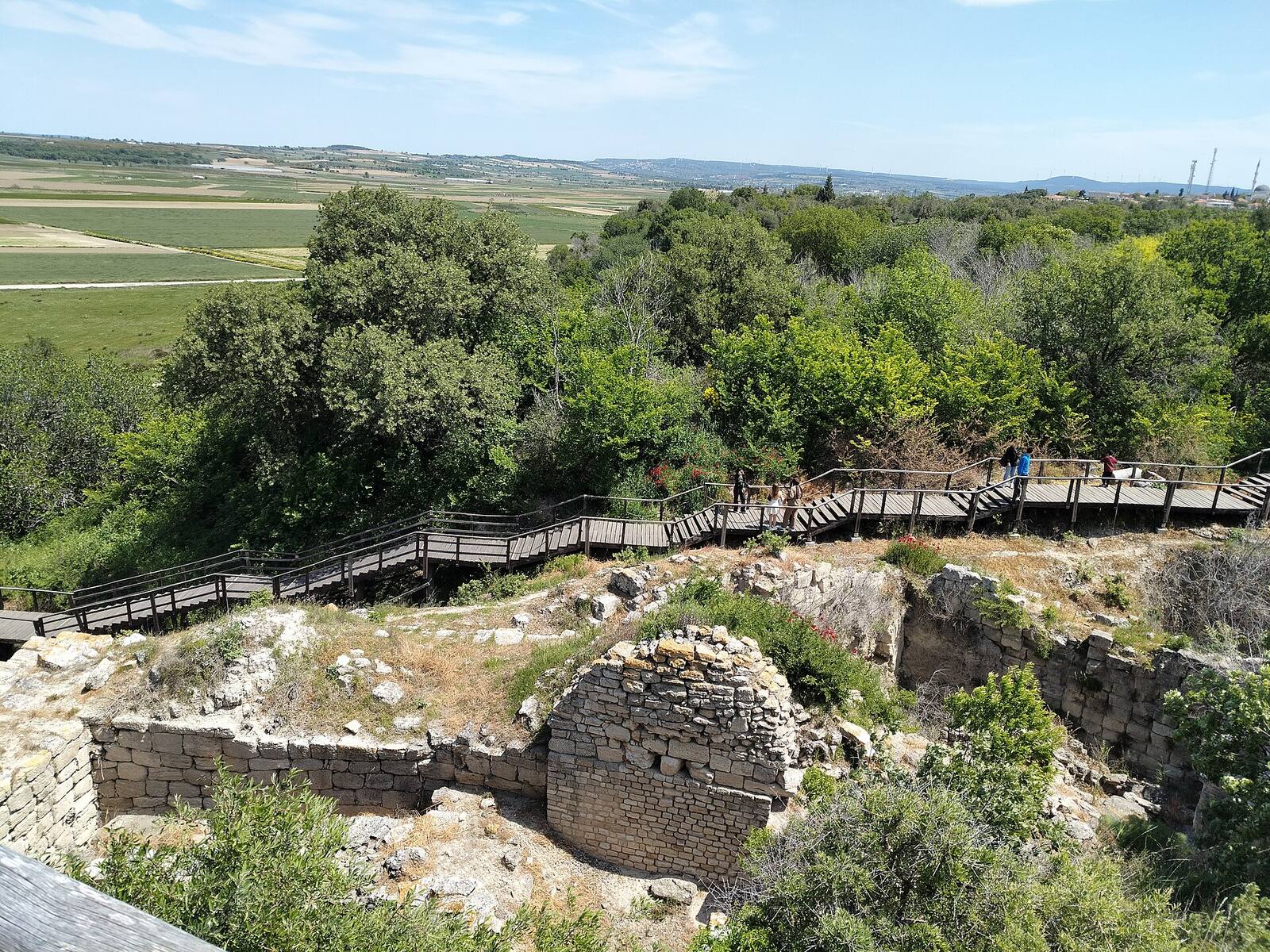
Same Hill, Same Wind, Same Birds, Same Sunset
The most extraordinary thing to contemplate when you visit Troy is that the wind blowing there is exactly the same wind. Homer calls Ilion “windy” more than a dozen times.The present-day name for this relentless north wind is poyraz; it funnels down from the Black Sea into the Dardanelles. Sailing ships cannot head straight into the wind; boats wanting to work their way up the strait had to anchor in the bay below and wait for the wind to turn, sometimes for weeks. While they waited, they paid for water, food and harbour dues. That is what made Troy rich.Source: On the wind, the current and the city’s position, Manfred Korfmann, “Troy: Topography and Navigation,” in Troy and the Trojan War, ed. Machteld J. Mellink (Bryn Mawr: Bryn Mawr College, 1986), 1–16. For the objection to reading Troy as a trading and harbour city, Frank Kolb, “Troy VI: A Trading Center and Commercial City?” American Journal of Archaeology 108 (2004): 577–613. So the air that tosses your hair when you stand in the ruins today is the same air that hummed in Hector’s ears as he looked down from the wall.
But there is something odd here. According to the Iliad, the walls are counted as within walking distance of the ships. In the film Troy, too, they were shown as walkable, if not exactly close. If the city’s reason for existing was the wind and the harbour, and the wind is still there, then where is the harbour? When you stand at Hisarlık and look out, you see no sea at all; you see flat fields, and the coast is 5–6 kilometres away.
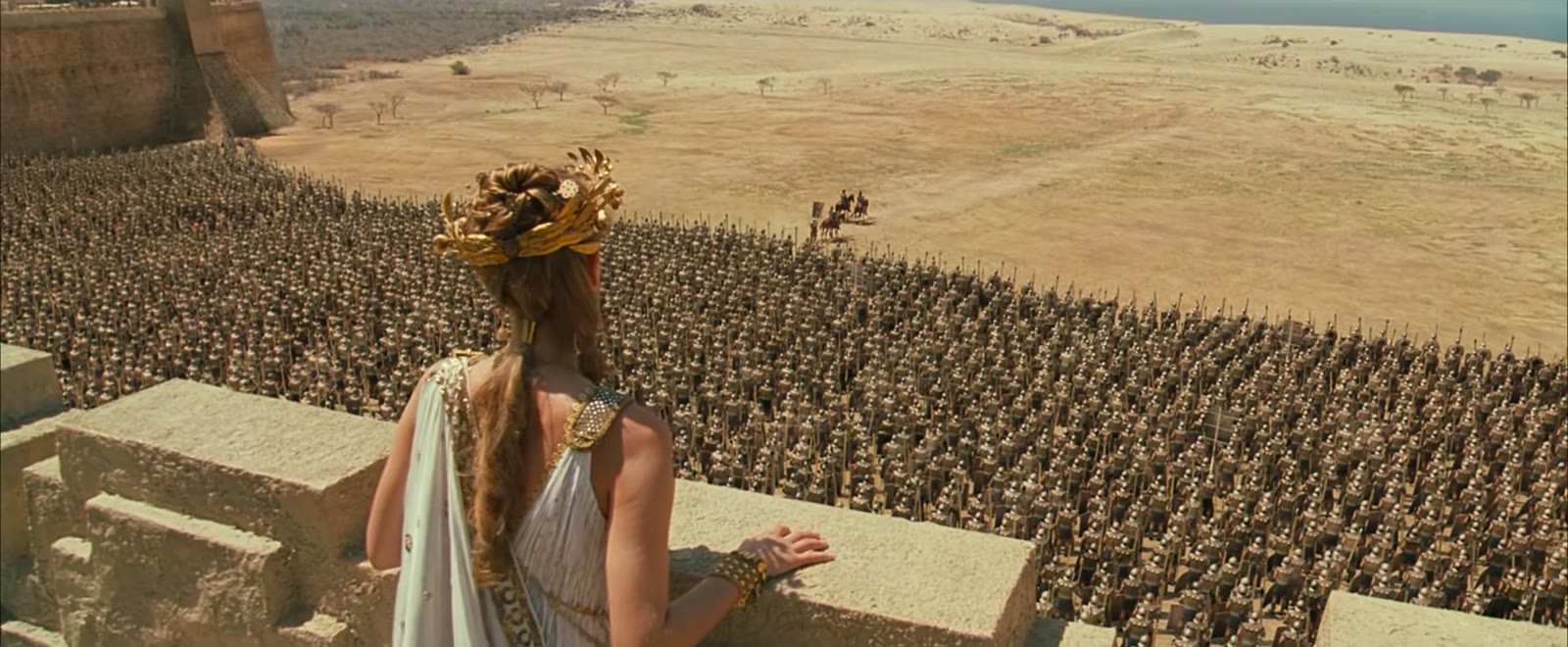
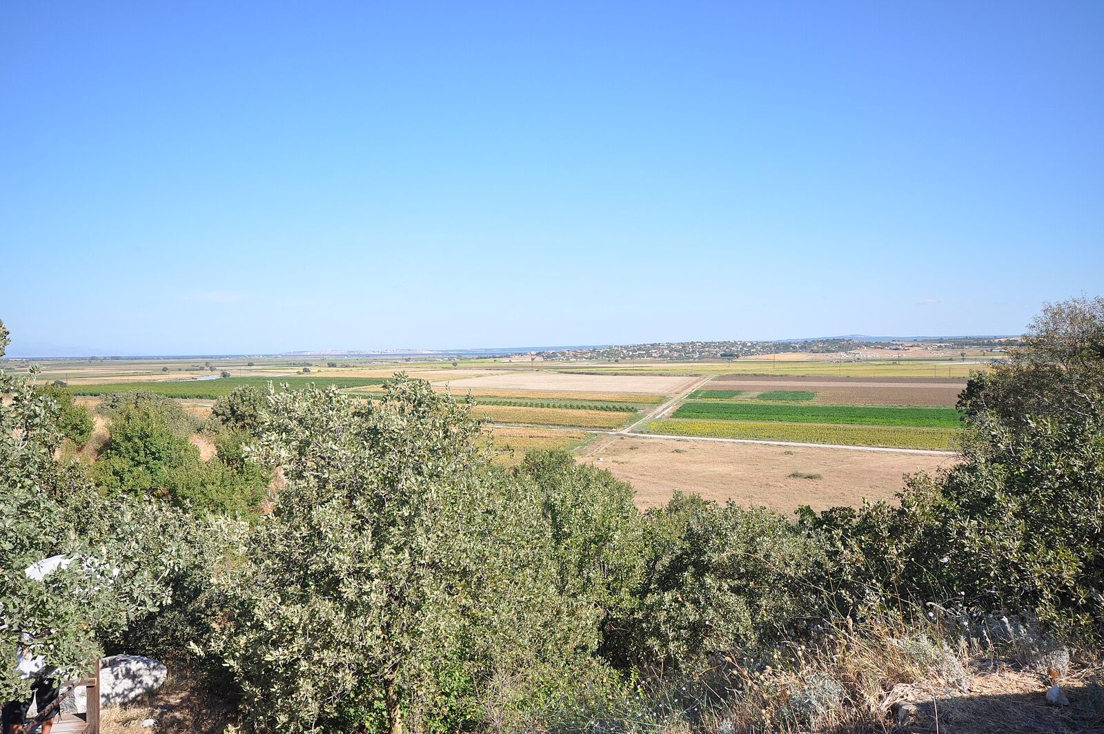
The only thing that changed was the geography. Troy once stood on the shore of a deep bay. Two rivers descending from Mount IdaHomer's Ida. The two rivers coming down from it: the Karamenderes (the epic's Scamander) and the Dümrek (Simoeis). carried alluvium for three thousand years; the bay first grew shallow, then became marsh, then dry plain.

At the time of the war the bay had partly silted up, but it was still a sheltered anchorage a few kilometres across. That must be where the Greeks drew their ships ashore. For a long time this was taken as proof that Homer had made everything up: the poet says soldiers went back and forth between the ships and the walls several times in a single day, which would have been impossible if the coast had been where it is now. Then, in the 1990s, geologists took deep cores all across the plain and brought up sea fossils, salt-marsh clay and beach sand from beneath the wheat fields. Around 1250 BC a bay really did reach far inland. It came right up to the spot where Homer places the Greek camp.Source: John C. Kraft, İlhan Kayan and Oğuz Erol, “Geomorphic Reconstructions in the Environs of Ancient Troy,” Science 209, no. 4458 (1980): 776–782; John C. Kraft, George Rapp, İlhan Kayan and John V. Luce, “Harbor Areas at Ancient Troy: Sedimentology and Geomorphology Complement Homer’s Iliad,” Geology 31, no. 2 (2003): 163–166. The core series were published alongside the excavation in İlhan Kayan’s reports in Studia Troica. The coastline and the geography were not like that in the period when Homer set it down in writing, which means this doesn’t show he invented it; on the contrary, it shows that a war fought 500 years earlier really was passed on by word of mouth across generations with these details intact. It’s an incredible thing. If you claim Homer made it up, could he have invented this geographical difference that was only proven later?
Where the Places in the Epic Are Today
The disappearance of the bay is the most dramatic change, but it is not the only one. If you take the Iliad with you and stand at Hisarlık, you can still find almost the entire landscape the epic describes right where it should be; mostly what has changed is only the names:Source (table below): Walter Leaf, Troy: A Study in Homeric Geography (London: Macmillan, 1912); J. M. Cook, The Troad (Oxford: Clarendon Press, 1973); Strabo, Geography XIII. For where each ancient name occurs, the relevant books of the Iliad.
| In the epic | Today | Note |
|---|---|---|
| Scamander (Xanthos in the language of the gods) | Karamenderes | Descends from Mount Ida and empties into the strait at Kumkale |
| Simoeis | Dümrek Çayı | Comes from the northeast and joins the Karamenderes on the plain |
| Ida | Kaz Dağları | Zeus watches the war from the peak of Gargaros; its highest point is 1,774 m |
| Tenedos | Bozcaada | Apollo’s island; where the fleet hid on the night of the wooden horse |
| Imbros | Gökçeada | The island that hides Samothrace when you look from the Trojan plain |
| Samothrace | Semadirek | The summit from which Poseidon watched the war |
| The headlands of Sigeion and Rhoiteion | The Kumkale–Yeniköy ridge and İntepe | The two capes holding the mouth of the bay; the Greek camp lay between them |
| Chryse | Gülpınar | The seat of the priest Chryses on the epic’s first page; the Temple of Apollo Smintheus still stands |
| Thebe (below Plakos) | Near Edremit | Andromache’s homeland; Achilles sacked it |
| Abydos | Nara Burnu | Among the Trojan allies; the narrowest point of the strait, where Xerxes built his bridge |
| Zeleia, on the Aesepus | Along the Gönen Çayı | Homeland of Pandarus, who shot the arrow for Troy |
| Dardania | Dardanelles | The strait’s name comes from Dardanus, Priam’s ancestor |
The Rivers
Homer says the Scamander’s name among the gods is Xanthos, that is, “yellow.” The water coming down from Mount Ida still runs the same yellow-brown today: because of the alluvium it carries. So the colour of the river and the material that buried the city are exactly the same thing. In book 21 of the Iliad this river, as a god, floods over Achilles, and the hero barely saves his life by clinging to an elm on the bank.The trees on the bank are the ones in the epic too: willow, tamarisk, elm. The Karamenderes still has the same temperament; it swings between a thin thread you can step over in summer and a flood that covers the plain in winter and spring. The Bayramiç Dam, completed in 1996, now holds it back upstream: the river that wrestled with Achilles today heads a network irrigating fifteen thousand hectares on the plain. In book 12 the gods join these very two rivers, the Scamander and the Simoeis, and sweep away the wall protecting the Greek ship camp. And indeed not a single stone of that wall has ever been found. The plain swallowed everything.Source: Iliad XX.73–74 (the name Xanthos), XXI.233–382 (the Scamander flooding over Achilles), XII.17–33 (the gods joining the two rivers and sweeping away the Greek wall). English text: Homer, The Iliad, trans. Richmond Lattimore (Chicago: University of Chicago Press, 1951).
The Two Springs
In book 22, as Achilles chases Hector around the walls, they pass two springs: one steaming hot, the other as cold as if it were full of ice even in midsummer; and beside them the stone troughs where the women of Troy washed clothes before the war. This single detail shifted the search, for most of the 19th century, to Pınarbaşı 10 km to the south, because there is no such hot-cold pair around Hisarlık. But in 1997 Korfmann’s team found something else south of the citadel: a cave and tunnel system cut into the rock, carrying water from underground. Uranium-thorium dating of the stalactites on its ceiling showed that the system came into use around 2900 BC, that is, in the very first centuries of Troy I, and continued in use into the Roman period.In the 2000s the plain’s springs were also surveyed hydrogeologically and hydrochemically; Homer’s pair of springs still has not been definitively matched. Groundwater holds a constant temperature year-round, and its mouth steams on a cold morning. On top of that, the Alaksandu treaty on the Hittite tablets counts an underground watercourse among the sacred witnesses of Wilusa. So beneath the city there is a water source that was cut two thousand years before the epic was written down, and was held sacred.Source: The two springs: Iliad XXII.147–156. The cave and tunnel system south of the citadel, and the uranium-thorium dating of its stalactites: Manfred Korfmann, “Troia: Ausgrabungen 1997,” Studia Troica 8 (1998). For the underground watercourse (KASKAL.KUR) among the divine witnesses of Wilusa, Beckman, Hittite Diplomatic Texts, no. 13.
The Shore Where the Ships Were Drawn Up
The epic places the Greek camp between two headlands: Sigeion and Rhoiteion. Both are still in place. One is the ridge on the Kumkale-Yeniköy side, the other is İntepe at the far end of the plain. The bay between them is farmland now, but because the two capes are still visible you can trace the camp’s boundaries with your eye. There is one alternative location as well: Beşik Bay, outside the strait, facing the Aegean.The poyraz is one reason ships waited in harbour; the other is the current: a surface current runs constantly down the strait from the Marmara toward the Aegean, reaching several knots at the narrows. Under sail you cannot beat against both the wind and the water. The 1982-87 excavations turned up a Bronze Age cemetery at the edge of the bay: a community buried with Mycenaean pottery, with women, men and children but no elderly. In other words, sailors who died there while waiting for the wind. Beşik is a beach today.Source: Manfred Korfmann’s preliminary reports on the Beşik-Tepe excavations, Archäologischer Anzeiger (1984–1988); final publication of the cemetery: Maureen A. Basedow, Beşik-Tepe: Das spätbronzezeitliche Gräberfeld, Studia Troica Monographien 1 (Mainz: Philipp von Zabern, 2000).
The Conical Mounds on the Plain
Standing in the middle of the fields and along the coastal ridges are conical mounds you can pick out from a distance: Sivritepe, Beşik Sivritepe, İntepe, Üvecik Tepe. Throughout antiquity these were pointed out as the tombs of the heroes; Sivritepe was held to be Achilles’ tomb, and another one overlooking the strait Ajax’s. These are the tombs Alexander poured oil on, the ones Mehmed asked the whereabouts of in 1462. They are still there today, and you drive right past them. The strange thing is this: not one of the excavated ones produced a Bronze Age warrior. The largest of them, Üvecik Tepe, turned out to belong to Festus, the friend for whom Caracalla staged the Patroclus-imitating funeral. So the mounds track not the epic but the epic’s admirers: the plain accumulated not only layers of city, but layers of pilgrimage.Source: For the excavation and identification of the tumuli on the plain, C. Brian Rose, The Archaeology of Greek and Roman Troy (Cambridge: Cambridge University Press, 2014), and J. M. Cook, The Troad (1973). Caracalla’s funeral for Festus: Herodian IV.8.4–5; Cassius Dio LXXVIII.16.7.
Where Poseidon Sat
In book 13, Poseidon watches the war “from the highest peak of wooded Samothrace”; from there, we are told, he sees Ida, Ilion and the Greek ships all at once. Standing on the Trojan plain and looking out, you cannot see Samothrace directly; Gökçeada stands in front of it. But Samothrace’s 1,600-metre Fengari summit is visible over the ridge of Gökçeada in clear weather.This is one of the reasons travellers coming to Troy since the 19th century have thought "Homer really did know this place." So the poet seated his god at the one point from which the whole scene is visible at once. Only someone who had stood there and looked at the horizon could pick that point.Source: Iliad XIII.10–14. On the visibility of Samothrace over the ridge of Gökçeada, Walter Leaf, Troy: A Study in Homeric Geography (1912), and Cook, The Troad (1973).
Almost Everything Else Stayed the Same:
- Ida, which Homer calls “many-fountained, mother of wild beasts,” still smells of red pine, thyme, marjoram and sage in the summer sun.
- In book 3 of the Iliad the clamour of the Trojan army is likened to “the cry of cranes.” That coast is a major migration route; storks and cranes still fly over the ruins every spring and autumn.
- BozcaadaIts ancient name is Tenedos. It still stands on the horizon at dusk, where Achilles looked. still stands on the horizon; the sun still falls into the Aegean and throws the same long golden shadows over the limestone and the yellow summer grass.
- When Homer describes the weak point of the wall, he gives the wild fig tree there (erineos) as the address; Andromache tells Hector to hold that spot. Wild figs still grow on the slopes of the mound.Source: Ida as “many-fountained, mother of wild beasts”: Iliad VIII.47 and XIV.283. The simile of the cranes: III.2–7. The wild fig tree (erineos): VI.433–439 and XXII.145.
- Flatbread baked on a hot stone, olive oil, salted sheep’s cheese, figs, heavy stews with chickpeas and broad beans, red wine cut with water against the midday heat. You could set the same table today.
Let’s Widen the Scale of Time a Little Further
It is a striking thing that the geographical changes around Troy go unnoticed within a single human lifetime, and that we can only see them in stories told across generations. Think of the layers in the city of Ilion: pick one lifetime out of each layer and consider how ordinary that life must have felt. As if everything had always been there and always would be.There is a name for this: the shifting baseline. Each generation measures change not against what came before it, but against the state of things it saw in its own childhood, and takes that state to be "natural." The term comes from fisheries. Daniel Pauly, "Anecdotes and the Shifting Baseline Syndrome of Fisheries," Trends in Ecology & Evolution 10, no. 10 (1995): 430.
The Geological Layers of the Same Plain
Now let’s adjust the lens a little. While we are looking down on Troy, let’s climb a bit higher: our planet, our solar system, the rest of the universe. All of us, as humanity, are also sitting in one layer of time on this earth. Never mind millennia; even for geology, millions of years are so short. Mountains that have existed forever as far as people are concerned look, at this scale, as if they formed yesterday, like a plant growing in a timelapse video. The tectonic plates are constantly on the move and the earth is constantly changing. In a sliver of time, humanity is born, evolves, exists. No different from a tiny ash layer at Troy.
The good news is this: you don’t even have to leave the plain to tell this story of scale. Everything we listed above sits on its own stack of layers: the mound, the plain, the rivers, the strait, the wind.
The hill is moving
GPS measurements show the Anatolian plate sliding westward along the North Anatolian Fault at about 2.2 centimetres a year.Source: Simon McClusky et al., “Global Positioning System Constraints on Plate Kinematics and Dynamics in the Eastern Mediterranean and Caucasus,” Journal of Geophysical Research 105, no. B3 (2000): 5695–5719; Robert Reilinger et al., “GPS Constraints on Continental Deformation in the Africa-Arabia-Eurasia Continental Collision Zone,” Journal of Geophysical Research 111 (2006): B05411. For the general framework of plate motion: A. M. Celâl Şengör and Yücel Yılmaz, “Tethyan Evolution of Turkey: A Plate Tectonic Approach,” Tectonophysics 75 (1981): 181–241. So since the day Hector looked out from the wall, Hisarlık has travelled about 70 metres toward the Aegean. And 110 metres since the first stone of Troy I was laid. As much as the width of the mound itself. We were counting the alluvium filling the plain as the “great change”; the ground underneath it had been sliding quietly all the while.
The mountain dates from yesterday
Homer’s “many-fountained” Ida, the Kaz Mountains, is roughly 25 million years old as a mountain.Source: Aral I. Okay and Muharrem Satır, “Coeval Plutonism and Metamorphism in a Latest Oligocene Metamorphic Core Complex in Northwest Turkey,” Geological Magazine 137, no. 5 (2000): 495–516. The rock inside it is far older; but the thing we call “the mountain,” that is, the landscape itself, took shape in the last 0.5% of the planet’s history. The peak from which Zeus watched the war rose, on the scale of the earth, only yesterday.
The sea is new too
The Mediterranean in front of Troy dried out almost completely between 5.96 and 5.33 million years ago; when Gibraltar closed, the basin evaporated and turned into a salt desert kilometres deep. Then Gibraltar opened again and the Zanclean flood filled the basin, perhaps in a few years, perhaps in a few thousand.Source: Kenneth J. Hsü, William B. F. Ryan and Maria B. Cita, “Late Miocene Desiccation of the Mediterranean,” Nature 242 (1973): 240–244; on modelling the speed of the flood: Daniel Garcia-Castellanos et al., “Catastrophic Flood of the Mediterranean after the Messinian Salinity Crisis,” Nature 462 (2009): 778–781. So the sea Achilles looked at is, in its present form, 5 million years old. Troy’s 4,500 years of unbroken settlement is less than a thousandth of the age of that sea.
Even the current in the strait is as young as human history
At the start of this piece we said that what made Troy rich was the northeasterly and the surface current coming down from the Marmara. For that current to exist at all, the Black Sea has to be connected to the Mediterranean. Yet until the end of the last ice age the Black Sea was a freshwater lake at a far lower level; the straits were closed.At the glacial maximum (about 20,000 years ago) sea level was 120–130 metres below today's. The Dardanelles was a river valley, and Bozcaada and Gökçeada were hills on dry land. You could walk to the places Homer calls "an island in the middle of the sea." About 9,000–7,000 years ago Mediterranean water came in through the Bosphorus and the lake turned into a sea. Incidentally, this event broadly resembles the flood story in Gilgamesh and the deluge in the major religions. It too may have been passed down orally from generation to generation across thousands of years.
Laid out in order, the mound itself takes up very little room at this scale:
| Layer | How long ago | Note |
|---|---|---|
| The Aegean opens, the Kaz Mountains rise | ~25,000,000 years | The landscape itself takes shape |
| The Mediterranean dries out and refills | ~5,300,000 years | The sea in front of Troy is this old |
| Homo sapiens | ~300,000 years | Modern humans appear |
| The Black Sea floods, the strait current begins | ~9,000 years | The current that will make Troy rich |
| Troy I | ~5,000 years | The first wall |
| The Trojan War | ~3,200 years | The middle of the mound |
| Homer has the epic written down | ~2,700 years | |
| Mehmed the Conqueror visits the mound | 564 years | |
| Schliemann starts digging | 156 years |
The Cosmic Calendar
Carl Sagan has a famous piece of scaling: compress the 13.8-billion-year history of the universe into a single calendar year.Source: Carl Sagan, The Dragons of Eden: Speculations on the Evolution of Human Intelligence (New York: Random House, 1977), chapter 1. For the age of the universe (13.787 ± 0.020 billion years) see Planck Collaboration, “Planck 2018 Results. VI. Cosmological Parameters,” Astronomy & Astrophysics 641 (2020): A6. For the age of the Earth (4.54 billion years) see Clair C. Patterson, “Age of Meteorites and the Earth,” Geochimica et Cosmochimica Acta 10, no. 4 (1956): 230–237. Let the Big Bang be midnight on 1 January, and today midnight on 31 December. On this calendar one day is 37.8 million years, one hour is 1.6 million years, and one second is about 440 years.
| Event | Real time | On the cosmic calendar |
|---|---|---|
| The Big Bang | 13.8 billion years ago | 1 January, 00:00 |
| The Earth forms | 4.54 billion years ago | 2 September |
| First traces of life | ~3.8 billion years ago | 21 September |
| The Kaz Mountains rise | ~25 million years ago | 31 December, 08:00 |
| The Mediterranean dries out | ~5.9 million years ago | 31 December, 20:15 |
| Homo sapiens | ~300,000 years ago | 31 December, 23:48:30 |
| The Black Sea floods | ~9,000 years ago | 31 December, 23:59:39 |
| Troy I is founded | ~5,000 years ago | 31 December, 23:59:48 |
| The Trojan War | ~3,200 years ago | 31 December, 23:59:52.7 |
| Homer has the epic written down | ~2,700 years ago | 31 December, 23:59:53.8 |
| Mehmed the Conqueror at Troy | 1462 | 31 December, 23:59:58.7 |
| Schliemann digs | 1870 | 31 December, 23:59:59.6 |
A human lifetime is a fifth of a second on this calendar. A blink takes 0.1–0.4 seconds. So your life is, quite literally, the blink of an eye.
The entire subject of this piece fits into the last twelve seconds of that calendar.
So Why Haven’t We Run Into Anyone?
Let’s climb a little higher still. Let’s look from the level of galaxies and of the whole universe: in a universe that is still a youthful 13 billion years old, how likely is it that other extraterrestrial civilisations would fall exactly within humanity’s minuscule 2-million-year span of existence?Fermi's question was asked over lunch at Los Alamos in 1950: "Where is everybody?" For the written account see Eric M. Jones, "Where Is Everybody?" An Account of Fermi's Question, Los Alamos technical report LA-10311-MS (1985). On the paradox being turned into a formal argument: Michael H. Hart, "An Explanation for the Absence of Extraterrestrials on Earth," Quarterly Journal of the Royal Astronomical Society 16 (1975): 128–135; Frank J. Tipler, "Extraterrestrial Intelligent Beings Do Not Exist," QJRAS 21 (1980): 267–281. Maybe we are the first; maybe hundreds of civilisations will arise, but by the time they do we will have begun and ended inside a tiny layer of time. Thinking in terms of distance and time scale, our overlapping with them looks very unlikely. The Fermi paradox may be predicting that, since there are so many planets out there, at least one of them ought to coincide with us, but to my mind that is an approach in terms of distance and number. Once we add the scale of time, the window for coinciding drops much, much further.
This intuition is in fact already inside the Drake equation, but it sits in its least discussed corner. Six of the equation’s seven terms ask “how many”: how many stars, how many planets, how many of them with life. The last one, L, is the only one that asks “for how long.” The lifetime over which a civilisation emits a detectable signal.Source: The equation was formulated in 1961 at the first SETI meeting at Green Bank; Frank D. Drake, “Project Ozma,” Physics Today 14, no. 4 (1961): 40–46. For the time dimension treated in its own right, Milan M. Ćirković, “The Temporal Aspect of the Drake Equation and SETI,” Astrobiology 4, no. 2 (2004): 225–231. And L is the least known number in the equation. Our own L is currently around 120 years. That is, since the first powerful radio transmitters.120 years is four ten-thousandths of the 300,000 years of Homo sapiens. And less than a hundred-millionth of the age of the universe. What we want is for this window to overlap with another window on another planet. Four ten-thousandths of the total age of our species. Even a band of ash in the mound is thicker than that.

What’s more, “at the same time” is undefined at these scales. The Milky Way is 100,000 light years across; by the time a signal from a civilisation at the far end of the galaxy reaches us, 100,000 years may have passed since that civilisation rose and fell. In the Trojan analogy: every signal we hold is a letter whose sender may already have turned into a layer of ash. Rather like Homer’s epic being written down 450 years later. Only the scale is four orders of magnitude larger.
What is interesting is that the modern version of this argument supports the intuition above. In 2018 a team from Oxford, instead of plugging a single “most plausible” number into each term of the Drake equation, put the range of uncertainty from the scientific literature into every term and sampled the result thousands of times. In the resulting distribution, the probability of being “alone in the observable universe” is not small at all. The paradox itself stops being a puzzle in need of solving.Source: Anders Sandberg, Eric Drexler and Toby Ord, “Dissolving the Fermi Paradox,” arXiv:1806.02404 (2018).
The “maybe we are the first” side has its defenders too. Red dwarfs burn for trillions of years; we are living today, when the universe is only a thousandth of the way through its star-making lifetime.Source: Fred C. Adams and Gregory Laughlin, “A Dying Universe: The Long-Term Fate and Evolution of Astrophysical Objects,” Reviews of Modern Physics 69, no. 2 (1997): 337–372. One study that calculates the likelihood of life as a function of cosmic time argues that the probability of life emerging will peak in the very distant future, around low-mass stars: if that is right, we are the early inhabitants of the universe, not the latecomers.Source: Abraham Loeb, Rafael A. Batista and David Sloan, “Relative Likelihood for Life as a Function of Cosmic Time,” Journal of Cosmology and Astroparticle Physics 2016, no. 8 (2016): 040. So perhaps we are Troy I: there are nine more cities to be built on top of us, and we know nothing of any of them.
There is a version of this that looks downward too. The Sun is growing brighter; the calculations say the biosphere on Earth may last another billion years or so.Source: Ken Caldeira and James F. Kasting, “The Life Span of the Biosphere Revisited,” Nature 360 (1992): 721–723. A billion years is twenty-six days on the cosmic calendar. So even the planet’s entire remaining future does not fill a single month on that calendar.
For someone standing at Hisarlık, none of this can be felt. The wind is the same wind, the smells the same smells, the sun sets in the same place. That is exactly the point this piece began with: seen from inside a single lifetime, everything looks static.
Photographs from Wikimedia Commons, under free licences: Schliemann’s trench (Dosseman, CC BY-SA 4.0) · East gate of Troy VI (Mosbatho, CC BY 4.0) · The Hisarlık mound (Barrowbob, CC BY-SA 4.0) · The plain (Jorge Láscar, CC BY 2.0).


.jpg)
.jpg)
Film stills: Troy (2004), dir. Wolfgang Petersen, Warner Bros.; brief excerpt for the purposes of criticism and commentary.